Take The First Step
see how AI & Robotics create real impact for your business.
Our experts are here for you
Thank you!
Your submission has been received!
Your submission has been received!
Oops! Something went wrong while submitting the form.
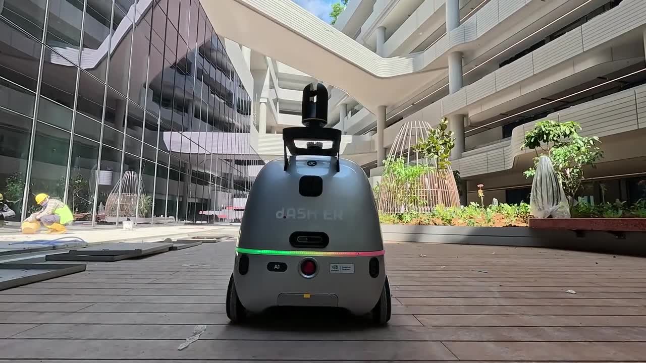
Conduct fast, high-accuracy site surveys using LiDAR and autonomous robotics.
01
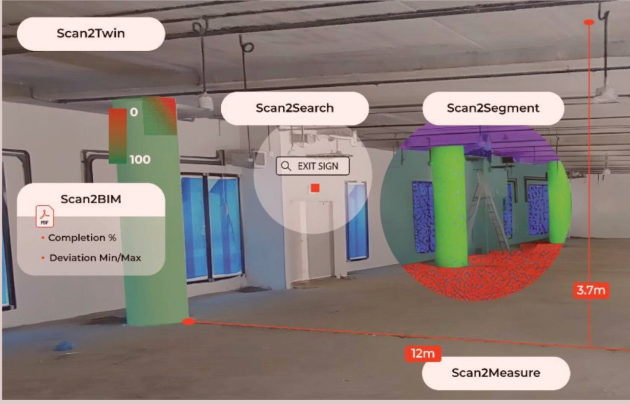
Fast, accurate 3D site capture.
02
Photoreal 3D with Gaussian Splatting.
03
Reliable volumetric measurement.
04
Automated change detection.
05
Object segmentation and search.
06
Seamless BIM / Autodesk integration.
Teams responsible for security, transport infrastructure, construction projects, and facilities management often struggle with incomplete or inconsistent site data. Manual measurements and fragmented photos make it difficult to verify progress, monitor conditions, or detect issues early across large, multi-level, or operational environments.
As a result, teams lack clear visibility into what is happening on site. Safety, accessibility, and operational constraints limit how frequently critical areas can be inspected, leading to delays, higher maintenance costs, operational risks, and inefficient decision-making.
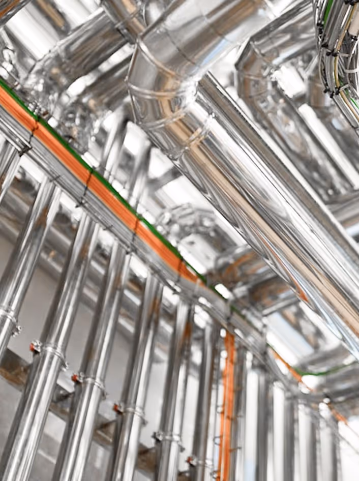
To address this challenge, high-precision LiDAR scanning converts physical environments into accurate digital models.
With Scan2Twin, Scan2Search, Scan2Segment, Scan2Measure, and Scan2BIM, teams can quickly explore spaces, locate assets, and extract precise measurements for faster verification and better operational decisions.
When a site is captured with d.ASH Pack, every corridor, wall section, and installation becomes part of a reliable 3D record. Teams no longer rely on scattered photos or subjective notes. Instead, a full floor can be documented within a single session, giving teams a clear and verifiable view of site conditions at any given time.
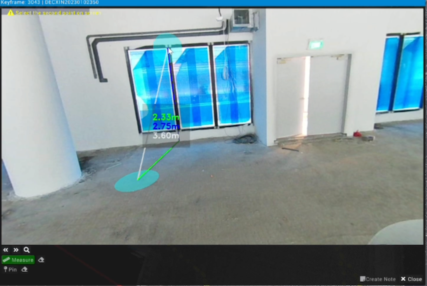
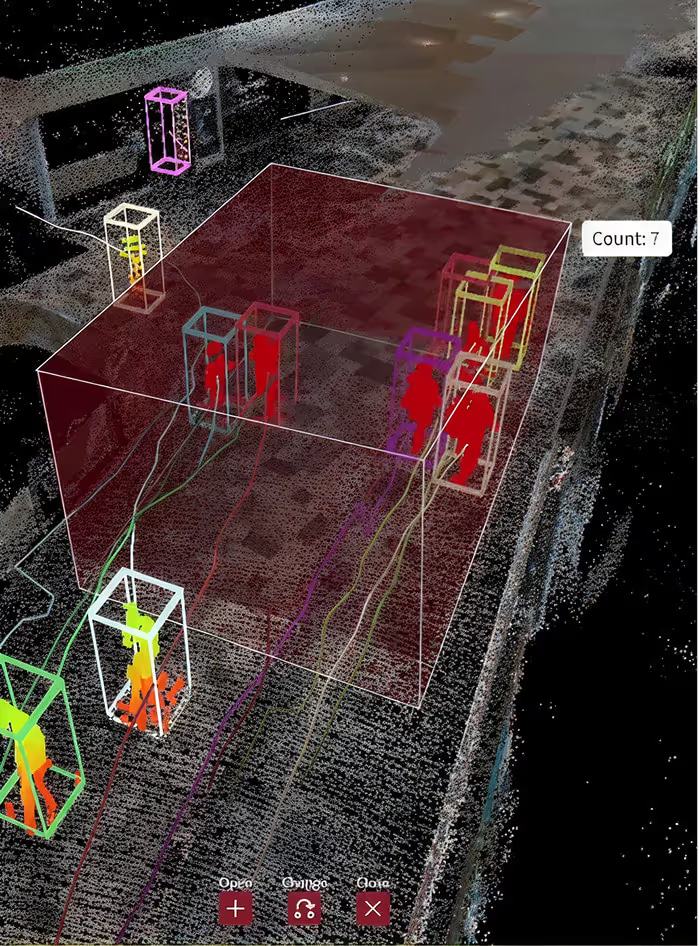
The scans are processed in d.ASH Xplorer to produce detailed 3D models that tell the full story of the site. Engineers can virtually revisit any point, review structural elements, verify installation accuracy, and measure distances or volumes with confidence. Areas that are difficult or unsafe to access can be examined remotely, reducing blind spots and enabling better decision-making.
Object segmentation and search make it easy to find equipment, infrastructure elements, and assets across the site. Whether reviewing installation progress, confirming completed work, or checking for missing components, the system provides the required information without manual searching.
All captured data aligns smoothly with BIM, digital twin, and Autodesk workflows, enabling teams to validate design intent, track changes across different stages, and maintain a single source of truth for quality and progress verification.
With consistent, high-fidelity site intelligence, teams gain the clarity needed to coordinate better, reduce rework, and keep projects moving on schedule.
From capture to analysis, our ecosystem streamlines operations and unlocks measurable impact for your business.
Follow us on Linkedin
dConstruct Robotics is a Singapore-based AI and robotics company (founded 2021) building end-to-end reality capture and robot automation tools—like d.ASH Pack and d.ASH Xplorer—for 3D mapping, analytics, and autonomous navigation across construction, facilities, and security.

Contact us to learn more about our products and ecoystem.
d.ASH ecosystem unites AI, robotics, robot navigation, 3D scanning, and digital twins. It enables reality capture and automated missions to improve safety and efficiency.
Autonomous robots with LiDAR, cameras, and IoT sensors deliver safe robot navigation indoors, outdoors, and in network-denied areas. They reduce risk and support 24/7 operations.
Construction, inspection, logistics, surveillance, and smart cities use AI-driven robots and digital twin software for BIM tracking, site surveys, monitoring, and fleet operations.
AI software transforms 3D scans into digital twins and reports, enabling faster progress tracking and mission planning.
We lead in AI innovation, robot navigation, and fleet management. Companies choose us for safer, smarter, and mission-ready automation solutions.
Take the next steps
Discover how autonomous navigation and reality capture enhance site operations with expert insights.
see how AI & Robotics create real impact for your business.
Partnering with
global leaders