3D Reconstruction Analytics & Insights Platform
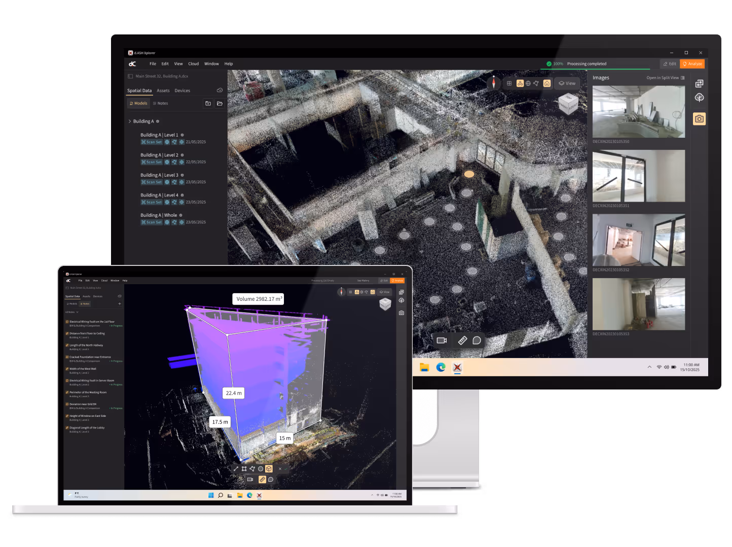
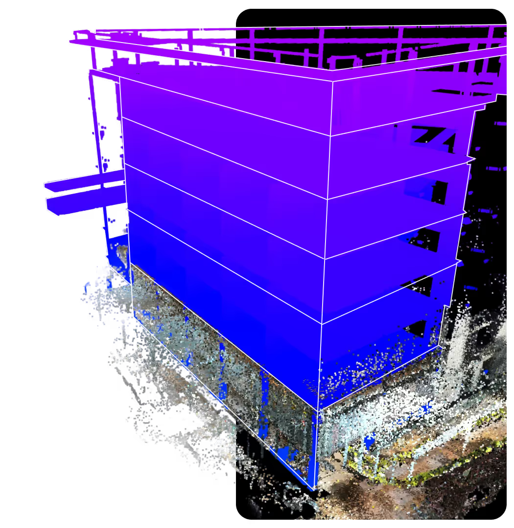
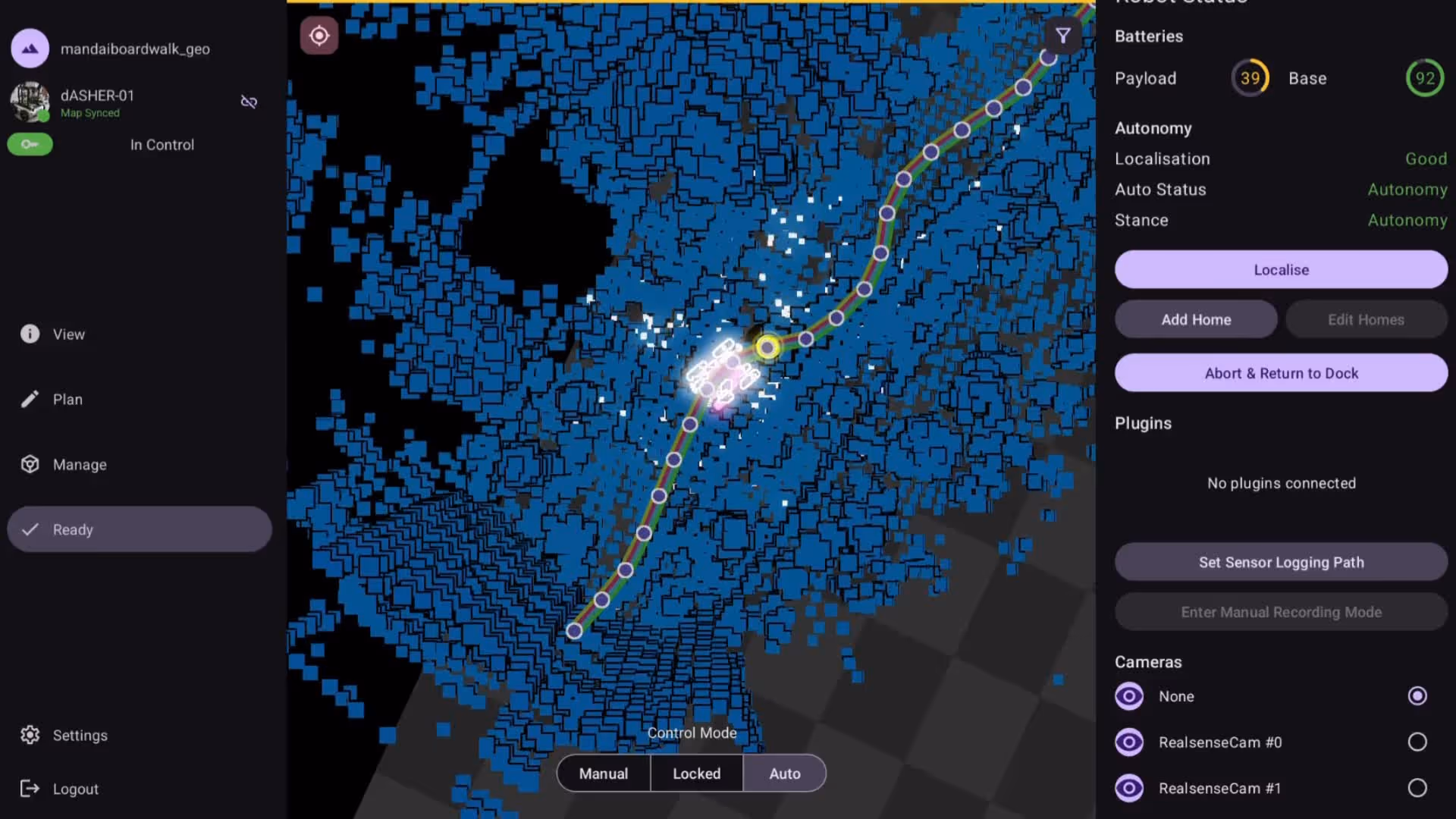
d.ASH Xplorer transforms 3D scans into precise digital twins. It delivers insights for BIM, measurements and object detection, while generating navigation-ready maps that drive robot autonomy.
High-Performance 3D Point Cloud Processor
Provide accurate spatial reconstruction and 3D SLAM
d.ASH Xplorer works with d.ASH Pack to process scans, edit maps, and sync directly to the cloud. Its advanced sensor fusion aligns and merges multiple scans automatically, delivering unified maps 3–5× faster than the scanning time.
Explore the features
Fast & Accurate Reconstruction
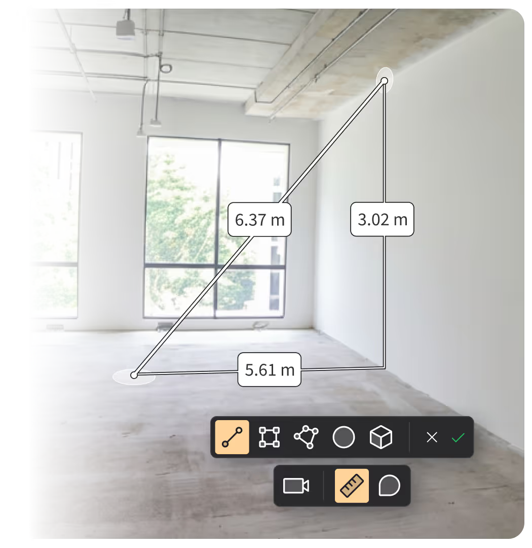
Quick and precise 3D mapping using our advanced custom SLAM algorithm.
Software
Ease-of-UseStreamline data processing and map editing in a single pipeline with seamless cloud integration for improved productivity. Easily manage multiple scanning projects.
Industry Standard Outputs
Export point cloud data to E57, LAS, XYZ, and DXF formats, convert it to meshes for Revit, Unreal Engine, Unity, and WebGL viewers, and fully integrate with Autodesk Construction Cloud®.
Large Scale
ProcessingAdjust point cloud resolution for various asset workflows to enhance data quality and efficiency. Generate high-density 3D point clouds for applications like digital twins.
Key benefits
Why d.ASH Xplorer
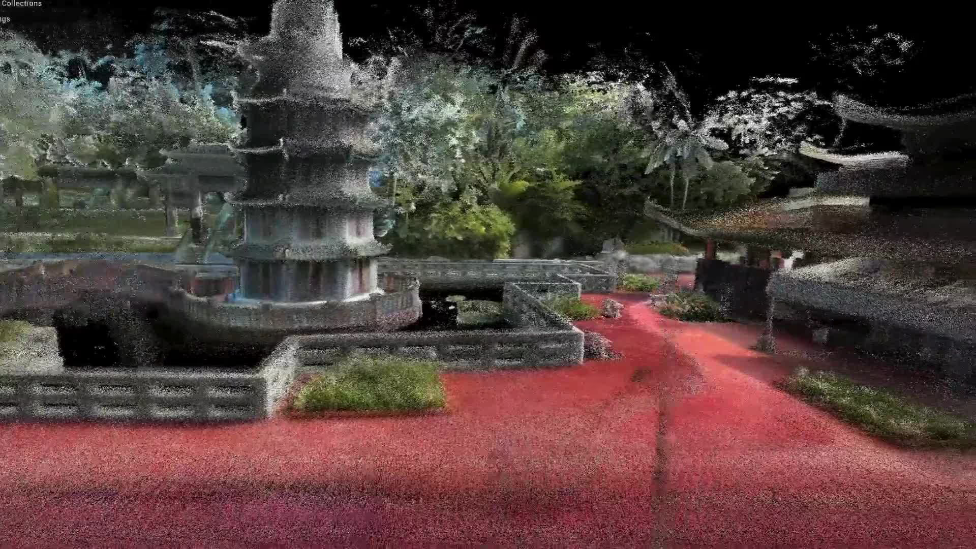
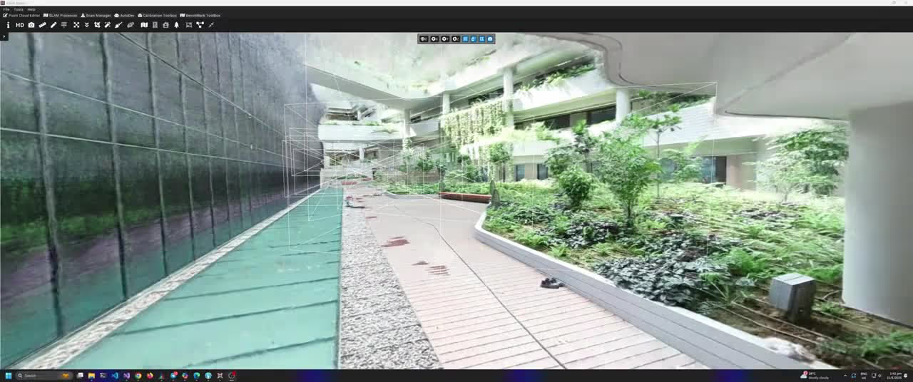
Beyond Photogrammetry: 3D neural reconstruction powered by Gaussian Splatting.
Fly through the scene in real time, inspect every angle, and take precise measurements with photoreal clarity.
Every detail is rendered with stunning precision, allowing you to explore, measure, and interact with the space in ways that were previously unimaginable. This is the future of spatial data—dynamic, immersive, and incredibly powerful.
00:00
/
00:00
Our team is here to answer your questions
Contact us to learn more about our products and ecoystem.
FAQ
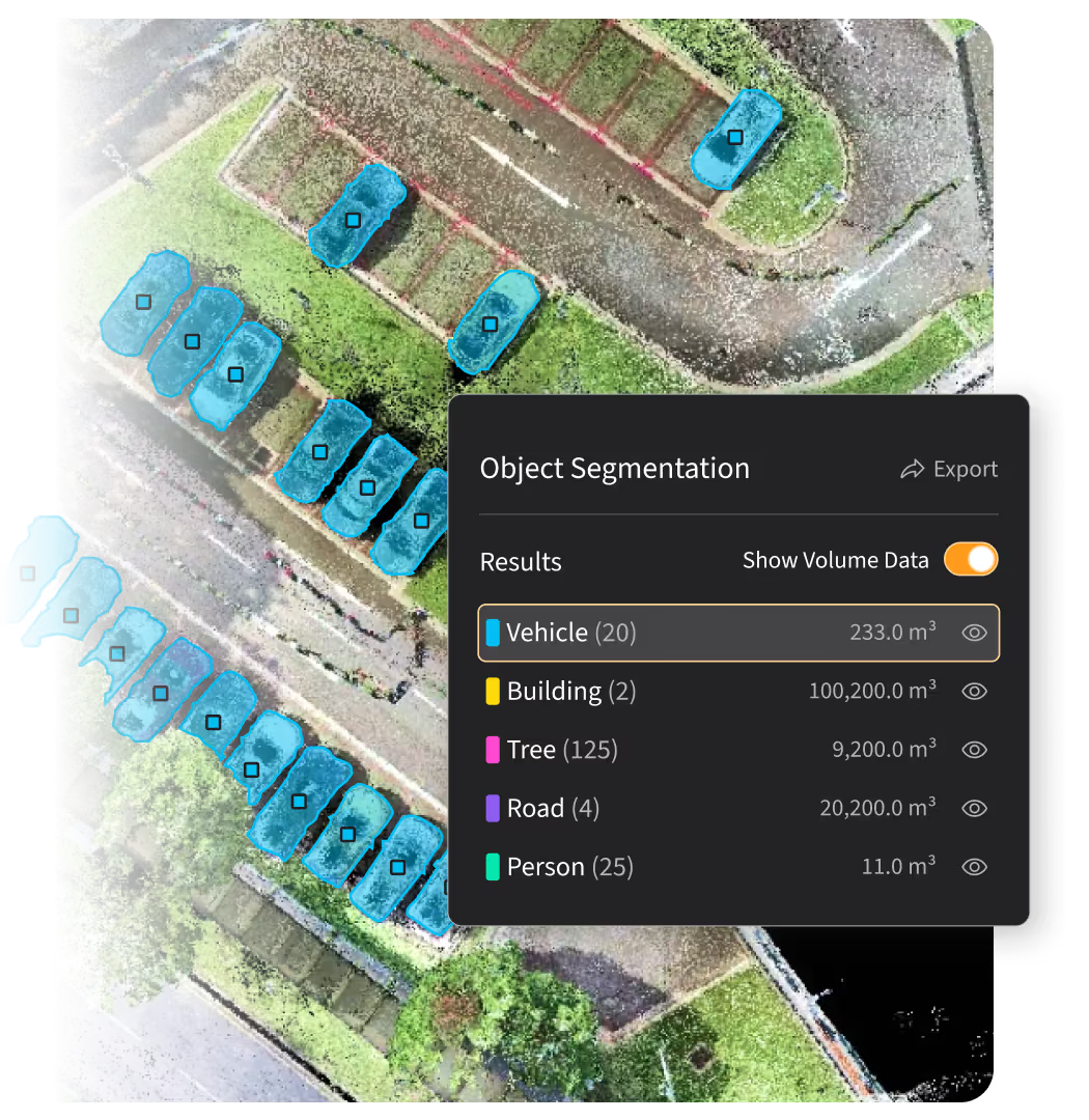
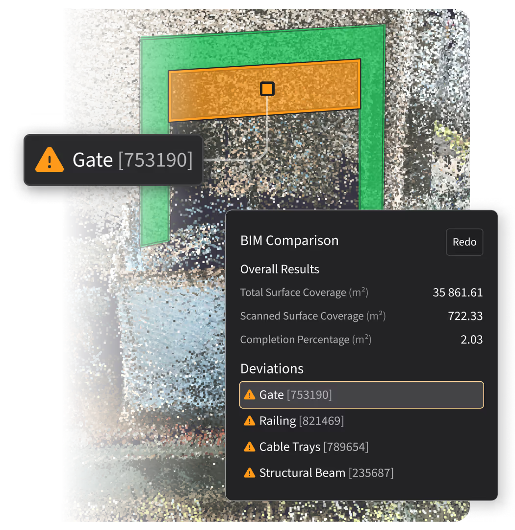
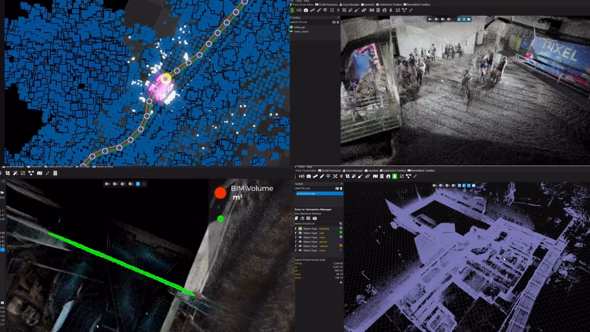
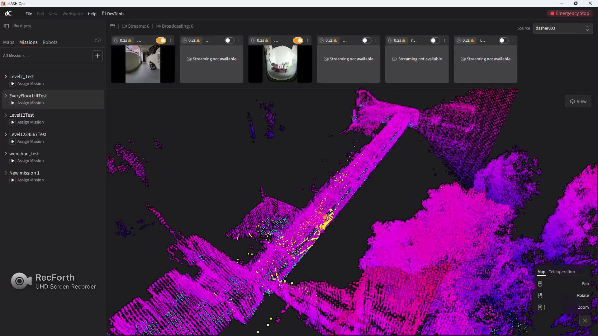
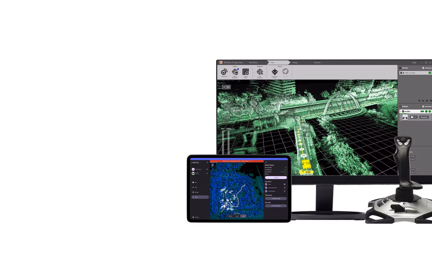
d.ASH Xplorer is a 3D reconstruction, analytics, and insights platform that converts LiDAR and visual scans into high-precision digital twins. It supports spatial measurement, object detection, and Scan-to-BIM comparison to help users analyze structures, monitor progress, and detect deviations. The platform also generates navigation-ready maps for autonomous robots.
It uses advanced SLAM and sensor fusion to align and merge multiple scans automatically. The system delivers accurate 3D spatial reconstruction up to 3–5 times faster than the scanning time and syncs results directly to the cloud.
You can export data in E57, LAS, XYZ, and DXF formats, and convert it to meshes for Revit, Unreal Engine, Unity, and WebGL viewers. The platform integrates seamlessly with Autodesk Construction Cloud for BIM workflows.
d.ASH Xplorer delivers fast and accurate 3D reconstruction through custom SLAM algorithms, offers a simple and intuitive software interface, supports industry-standard data outputs for BIM and visualization tools, and handles large-scale point cloud processing for digital twin applications.
d.ASH Xplorer goes beyond photogrammetry with 3D neural reconstruction powered by Gaussian Splatting. It lets users fly through the scene, inspect from any angle, and take precise measurements while delivering photorealistic detail, real-time performance, compact file sizes, and seamless integration with digital twin and BIM tools.
Take the next steps
Discover d.ASH Xplorer &
more specifications
See more in detail how this software can help
d.ASH Platform:
All-in-One Robotic Intelligence

00:00
/
00:00
00:00
/
00:00
00:00
/
00:00
00:00
/
00:00
Products
Discover the full experience
- Hardware
 Operate
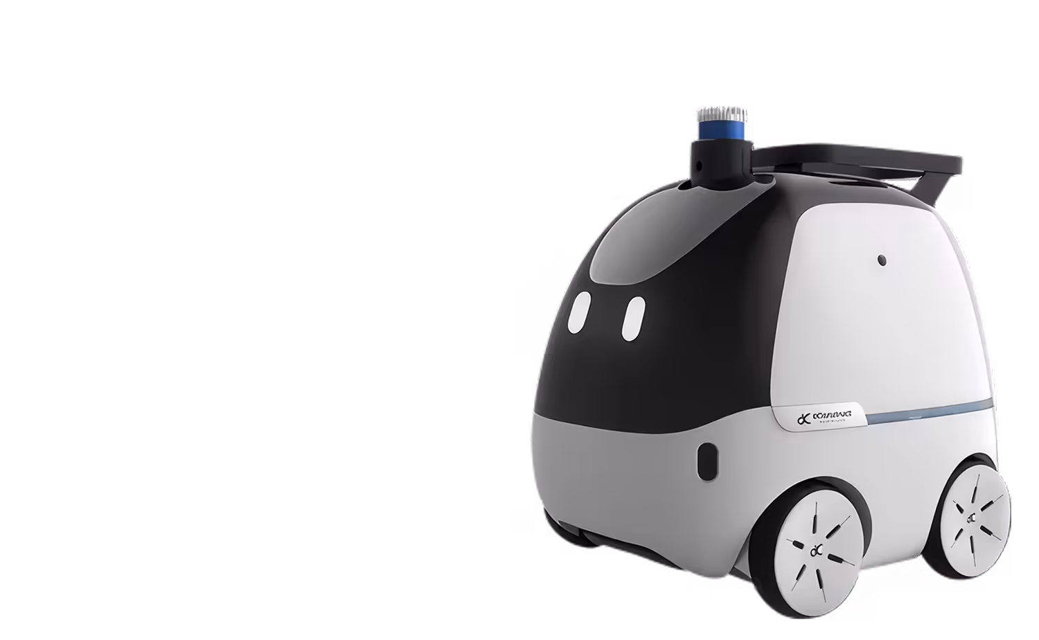
Multi-Functional Autonomous Robot
- Hardware
 Scan
ScanFast & Accurate Large-Scale Reality Capture
- Software
 Configure
Robotics Fleet Management Platform
Take The First Step
see how AI & Robotics create real impact for your business.
Your submission has been received!
Partnering with
global leaders