Portable LiDAR Reality Capture for Faster Decisions
Deliver accurate spatial data for mapping, reconstruction, and autonomous navigation.
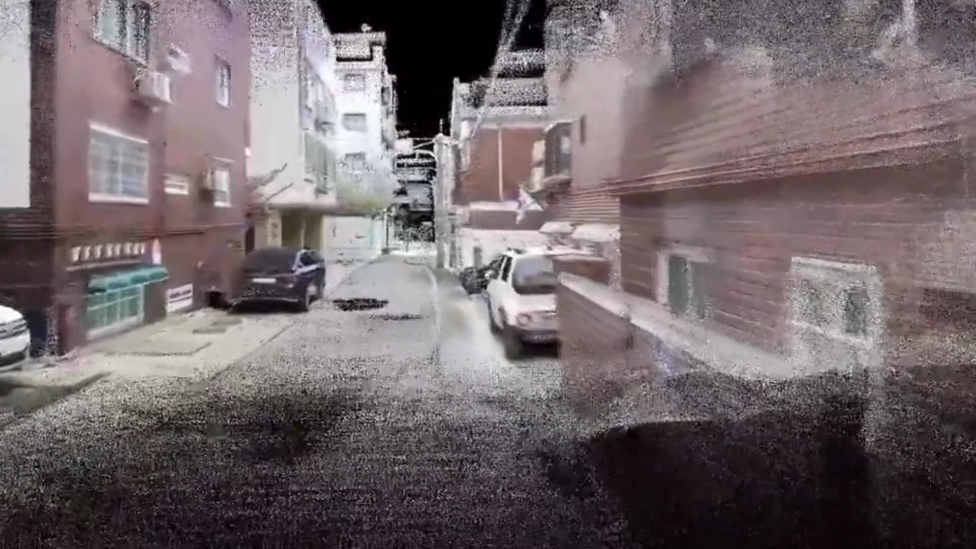
Fast, Accurate, Large-Scale 3D Spatial Data Capture
Transform Site Scanning — Reduce Costs, Increase Accuracy
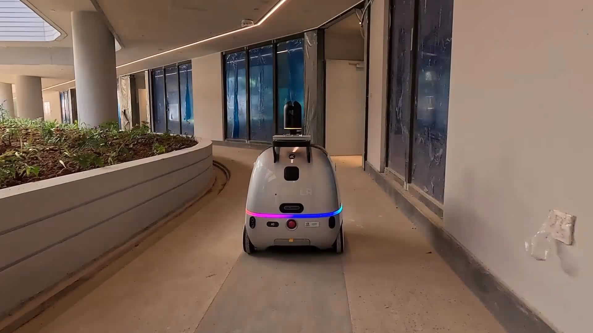
Capture large, complex environments using backpack or robot-mounted mobile mapping systems. Achieve centimetre-level accuracy across indoor, outdoor, multi-floor, and uneven terrains to minimise scanning time and operational cost.
Explore the features
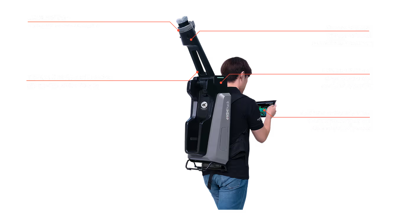
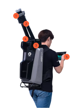
LiDAR Scanner
Camera Sensors
LED Status Panel
Tilted or Upright
dash Go Companion App
High Performance 3D Mapping
Mobile SLAM scanning (backpack or robot‑mounted) with Ouster LiDAR for high‑definition colored/non‑colored point clouds.
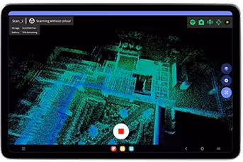
On-The-Go Mapping
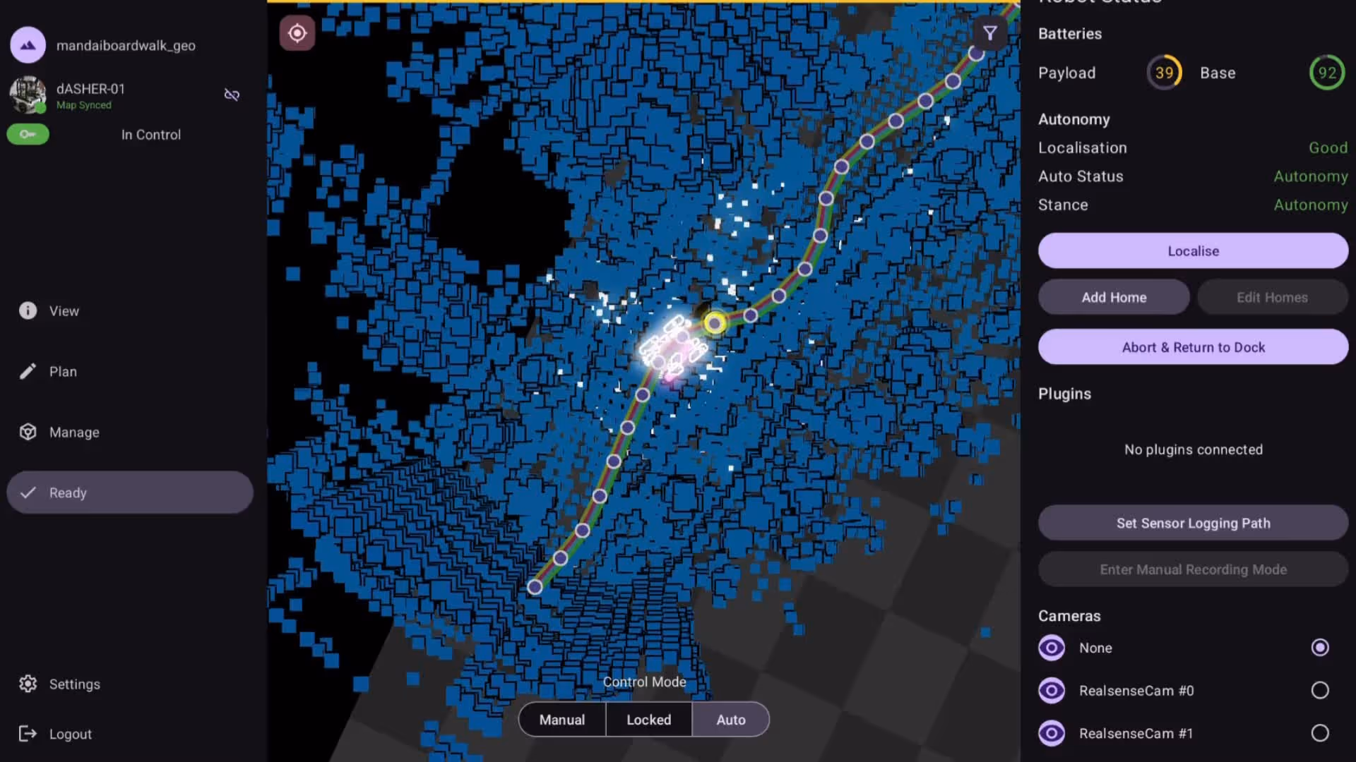
Stream real‑time coordinates in our d.ASHPack GO App. Visualize coverage, and optimize paths, reducing the need for re‑scans.
Battery Life (+3h)
3hrs+ per field session for confident large‑area coverage.
Indoor / Outdoor
OperationMulti‑floor, uneven terrain support for large‑scale “scan‑on‑the‑go” workflows.

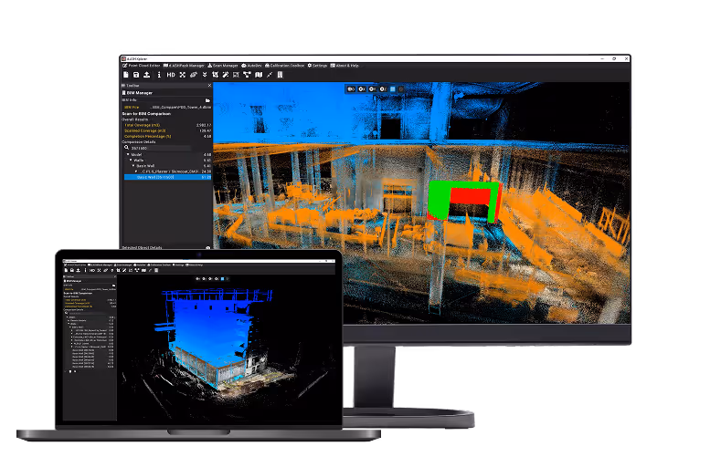
Unlock Insights with d.ASH Xplorer
Scan with d.ASH Pack and unlock instant insights in Xplorer—whether it’s BIM validation, measurements, or object detection, your data is ready for action
Our team is here to answer your questions
Contact us to learn more about our products and ecoystem.
FAQ
d.ASH Pack is a portable LiDAR reality capture system designed to digitise environments with centimetre-level accuracy, allowing users to capture large or complex sites quickly while visualising coverage live through the d.ASHPack Go app.
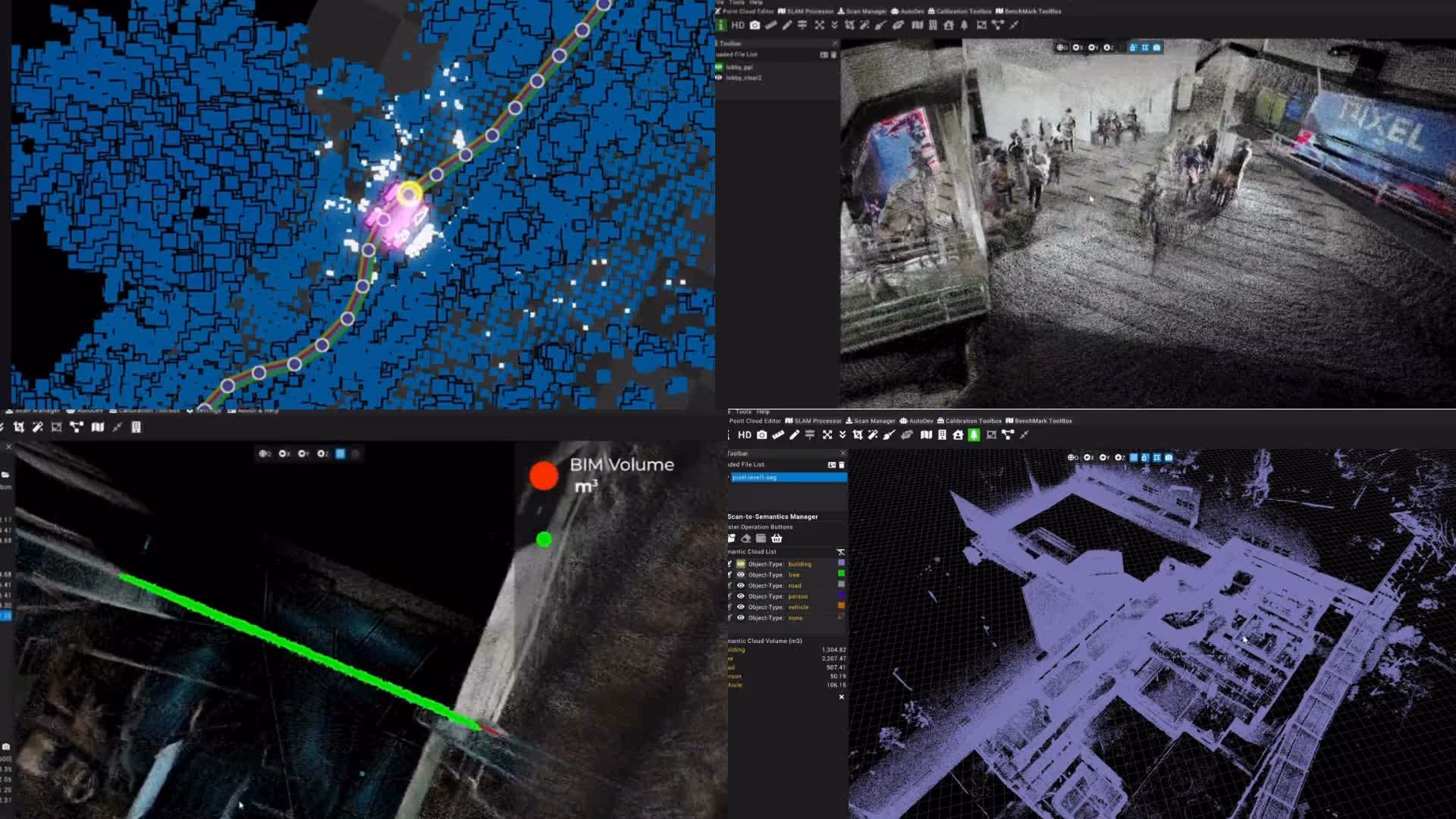
d.ASH Pack combines the Ouster LiDAR sensor with advanced SLAM algorithms to deliver centimetre-level mapping accuracy. It captures both coloured and non-coloured point clouds in real time, enabling precise reconstruction of indoor and outdoor environments for construction, inspection, surveillance, facility management, and autonomous robot navigation.
Data captured by d.ASH Pack can be imported into d.ASH Xplorer for advanced visualisation and analysis. Within Xplorer, users can view detailed 3D reconstructions, take measurements, identify structural changes, and extract actionable insights from point cloud data.
Take the next steps
Get a high-precision digital twin of your site in just hours with d.ASH Pack
Discover how autonomous navigation and reality capture enhance site operations with expert insights.
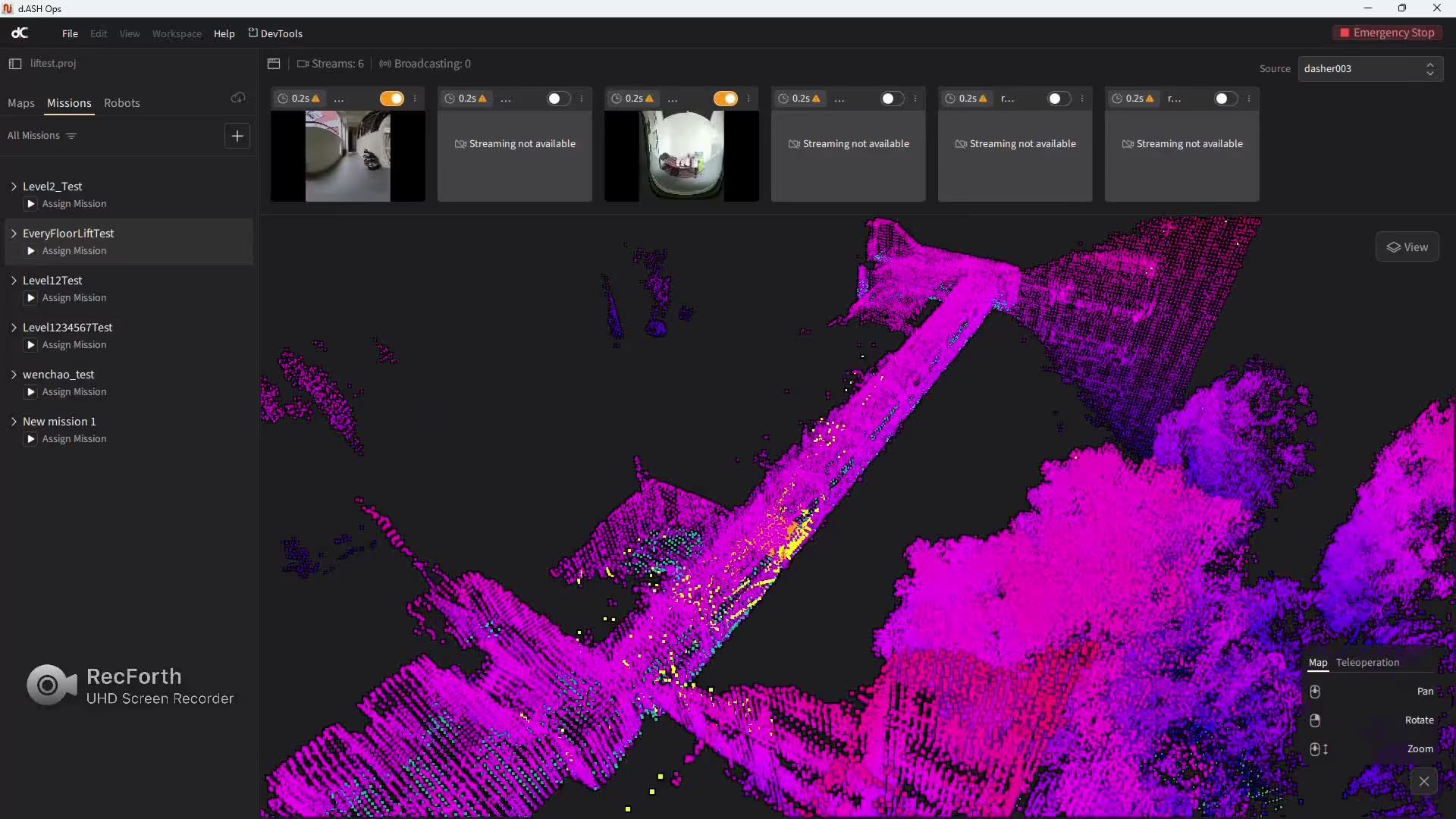
d.ASH Platform:
All-in-One Robotic Intelligence
00:00
/
00:00
00:00
/
00:00
00:00
/
00:00
00:00
/
00:00
Products
Discover the full experience
- Hardware
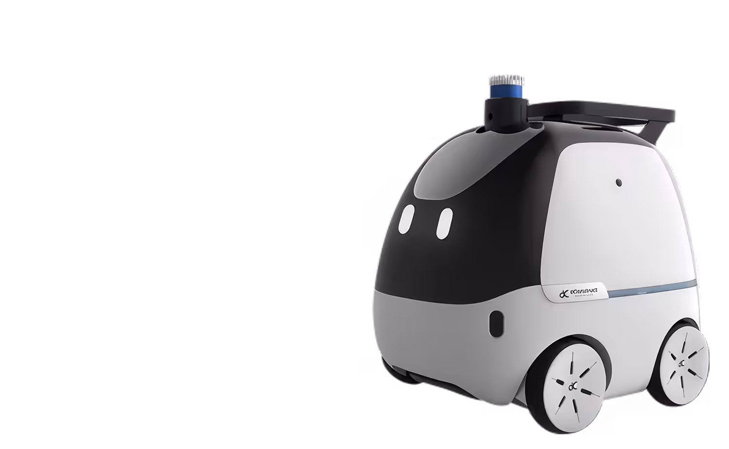 Operate
Multi-Functional Autonomous Robot
- Software
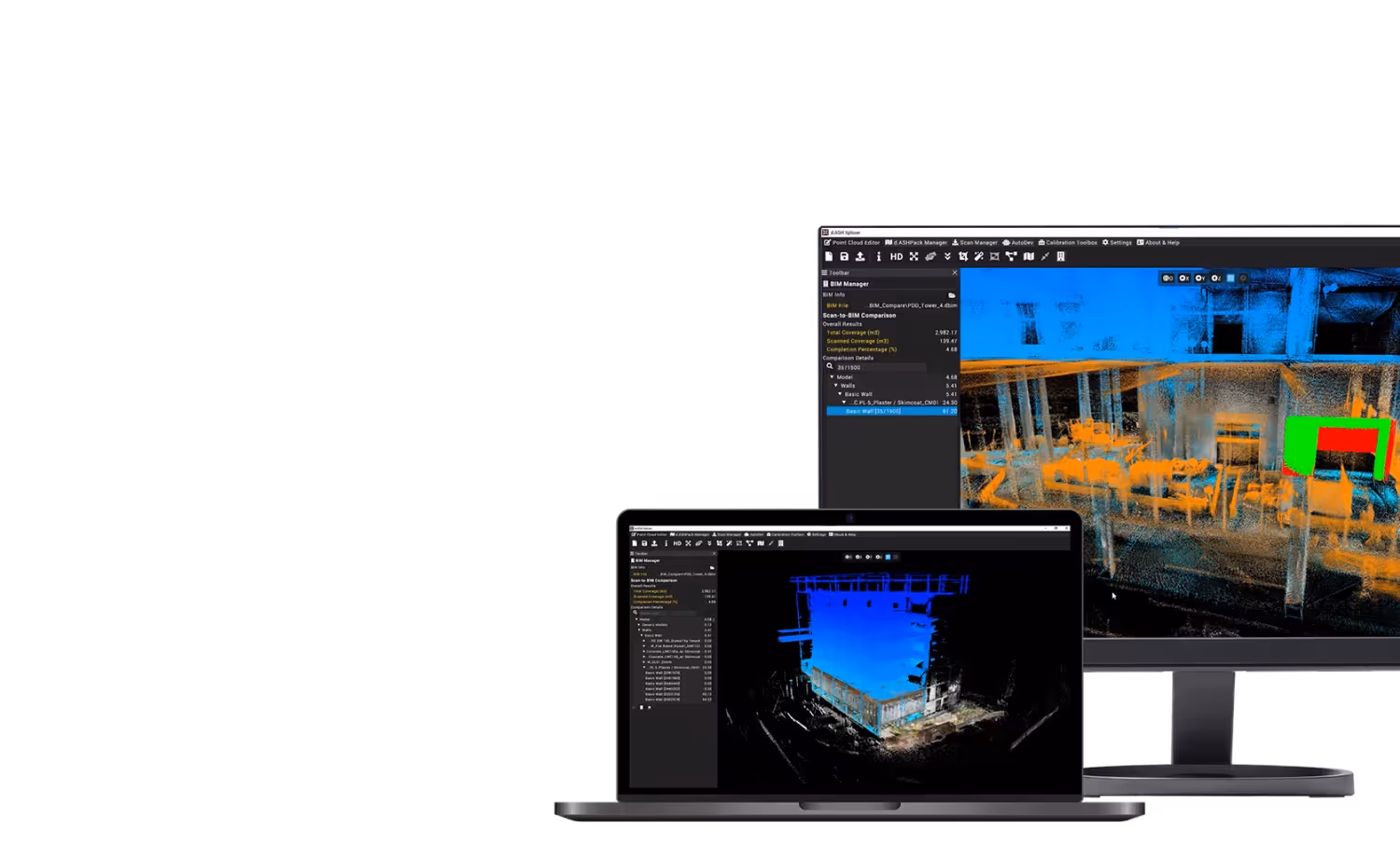 Analyze
High-Performance 3D Map Processor
- Software
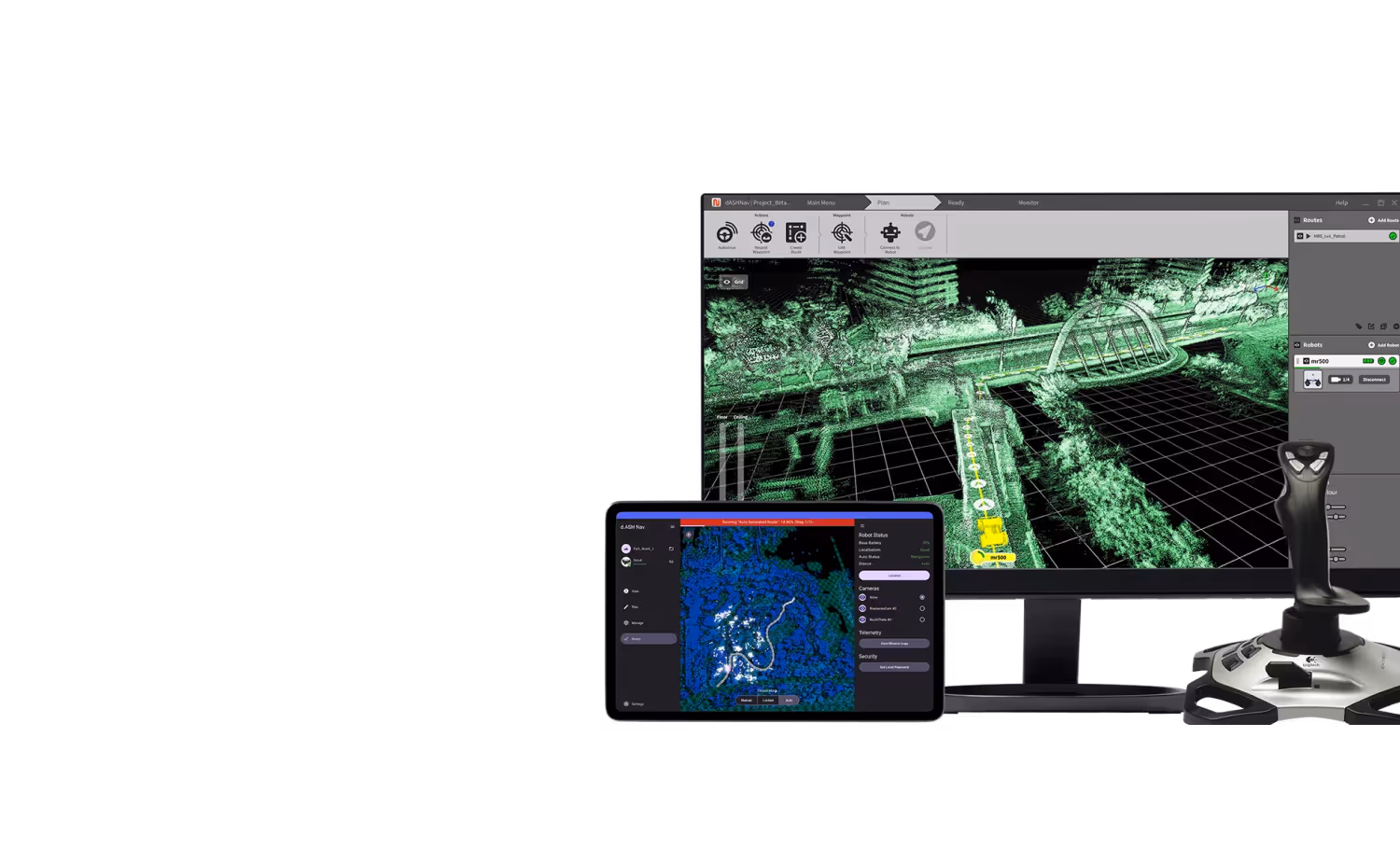 Configure
Robotics Fleet Management Platform
Take The First Step
see how AI & Robotics create real impact for your business.
Your submission has been received!
Partnering with
global leaders