LiDAR Based Virtual Inspection Project
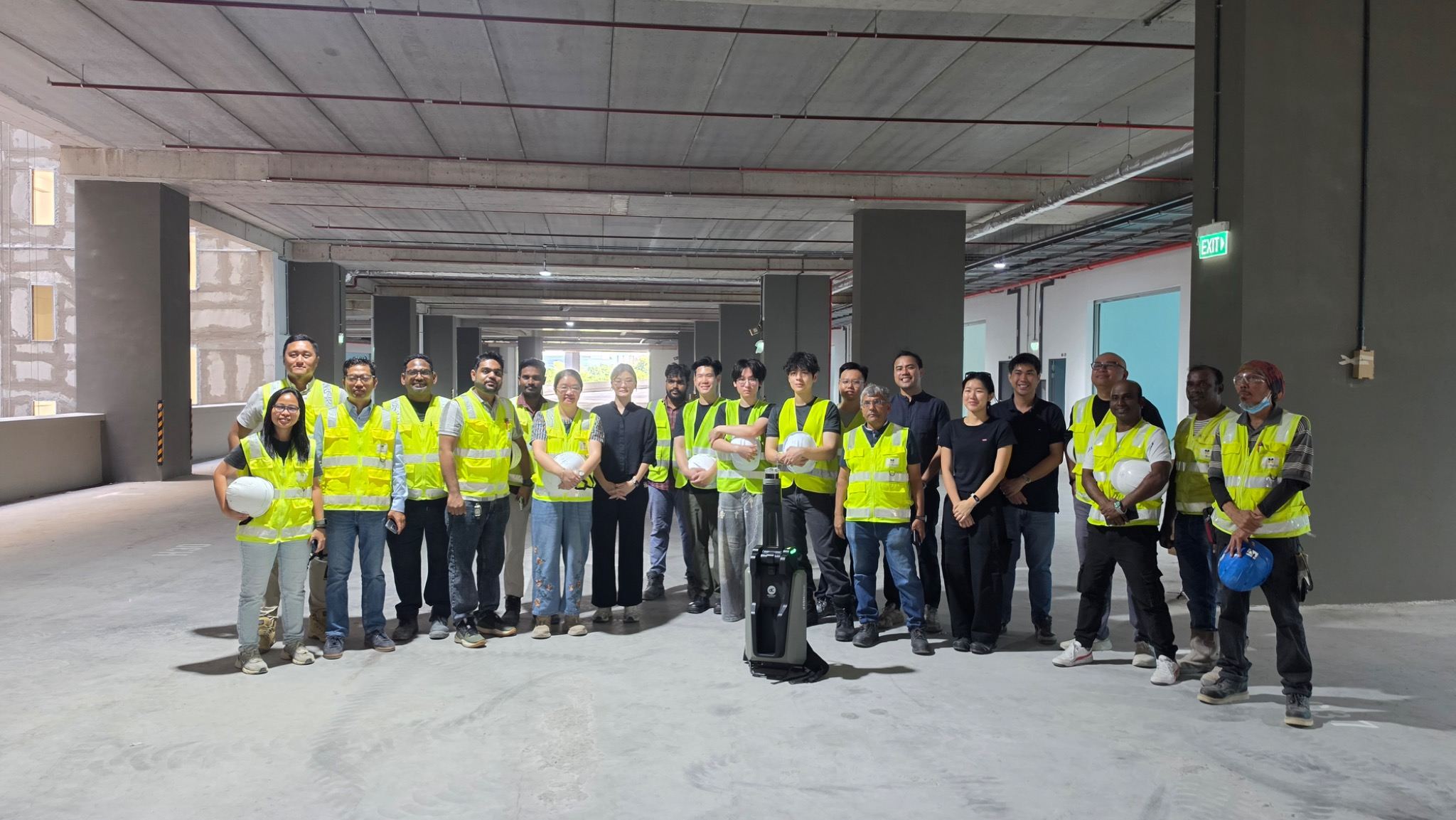
Supported by Building and Construction Authority, SoilBuild Construction and dConstruct Robotics
Overview
The Building and Construction Authority (BCA) explored the potential of emerging technologies to enable more efficient and streamlined virtual inspection processes. As part of this initiative, BCA assessed how 3D LiDAR scanning could reduce reliance on traditional inspection methods while improving the accessibility, consistency and reliability of site information.
Building on its existing reality-capture capabilities, dConstruct Robotics proposed d.ASH Pack, a LiDAR-enabled reality capture device designed to support digital twin creation and remote inspection workflows. To test and validate the technology in real-world project environments, BCA, SoilBuild Construction and dConstruct Robotics came together in a three-way partnership to conduct sandbox scanning projects at Soitec and DB Schenker.
Insights from these sandbox projects informed the subsequent first full LiDAR virtual inspection for industrial project TOP (Temporary Occupancy Permit) conducted at a SoilBuild site, Tampines Connection. The pilot demonstrated how LiDAR-enabled reality capture could support virtual inspection workflows and enhance the way site information is captured, accessed and reviewed.
The outcomes from the three projects help contributed to the development of the first edition of the Guidebook for LiDAR Virtual Inspection, which sets out the requirements for conducting, processing and submitting LiDAR captures, to support the wider adoption of LiDAR technology for inspection across the built environment.
The Opportunity
Traditional site inspections can be time-consuming, particularly for large developments where inspectors and project teams may need to make multiple site visits to review, clarify and verify issues.
This is a familiar operational challenge for construction companies such as SoilBuild Construction. As Gerald Ho, Project Director, Head of Digitalisation at SoilBuild Construction, explains: “Obtaining TOP through the traditional process will normally involve BCA officers, consultants, main contractors and subcontractors coming together for a mass site walk on the day of inspection. We saw an opportunity (with LiDAR technology) to make the entire process more efficient while providing better accountability throughout the project lifecycle.”
With reality capture platforms, large construction sites can be digitally documented and reviewed remotely. This creates an opportunity to:
· Reduce the number of physical site visits, measurements and back-and-forth required during inspections.
· Improve inspection productivity across large sites.
· Provide inspectors with a measurable, visual record of site conditions.
· Enable construction teams to respond to inspection comments more quickly.
· Maintain a clear digital record of observations, clarifications and non-compliances.
While 360° imagery offers a fast and cost-effective way to document spaces visually, dConstruct’s reality capture tool complements this by using LiDAR to generate precise, measurable spatial data that can be explored and reviewed within a 3D environment. This helps to reduce photo evidence needed to show dimensional compliances.
First Full LiDAR based Virtual Inspection for Industrial Project TOP:
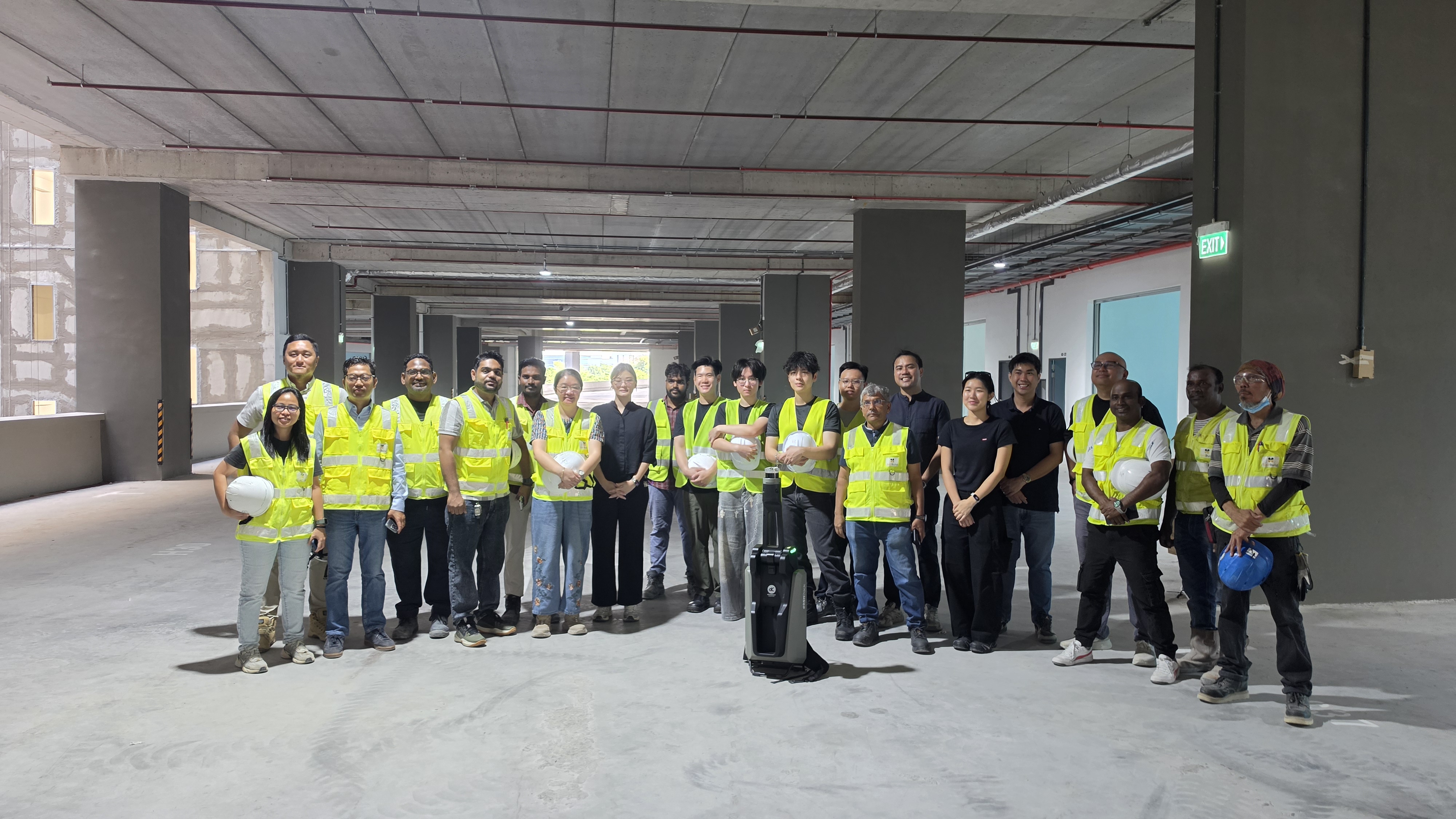
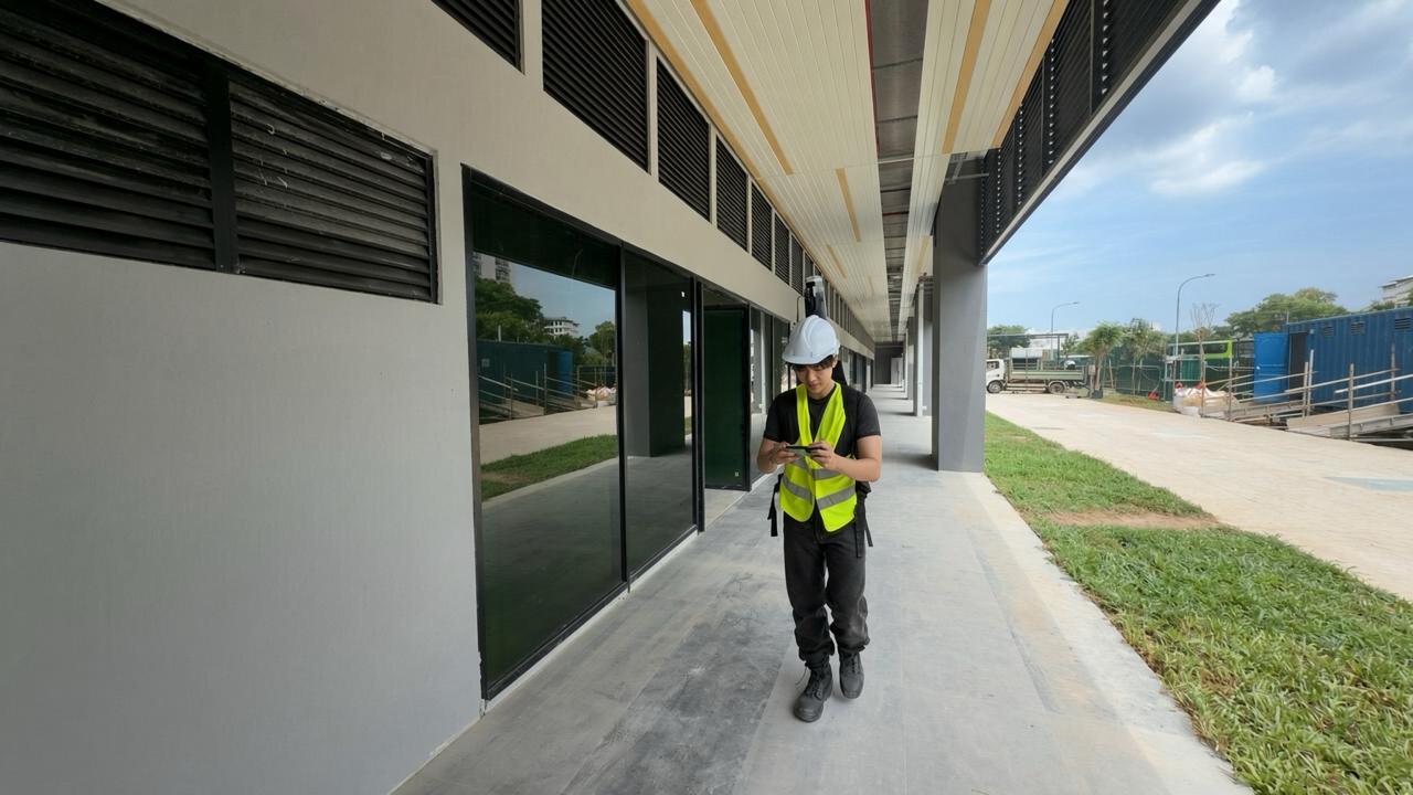
With the support of BCA and SoilBuild Construction, dConstruct Robotics put its d.ASH Pack and Xplorer to the test. A digital twin of SoilBuild’s Tampines Connection site was created using the d.ASH Pack. With a two-person operating team, the approximately 5.54-hectare site was scanned within six hours.
Following the scan, dConstruct generated a 3D point cloud for SoilBuild’s internal review. Once the captured data was approved, BCA proceeded with the virtual inspection using the d.ASH Xplorer, 3D point cloud reconstruction and analytics platform.
Through the 3D point cloud environment, BCA inspectors were able to:
· Navigate and review the site remotely.
· Take measurements directly within the captured environment.
· Identify and annotate specific locations.
· Record inspection comments against the relevant areas of the site.
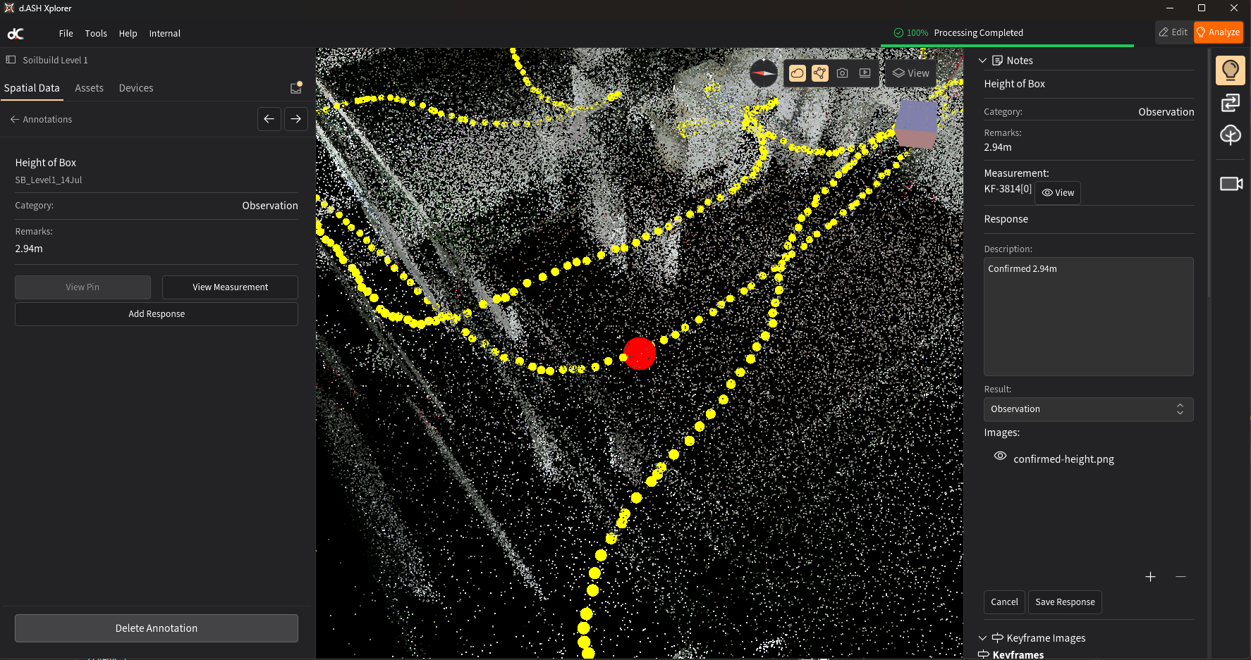
· Categorise comments as: Observation, Clarification or Non-Compliance.
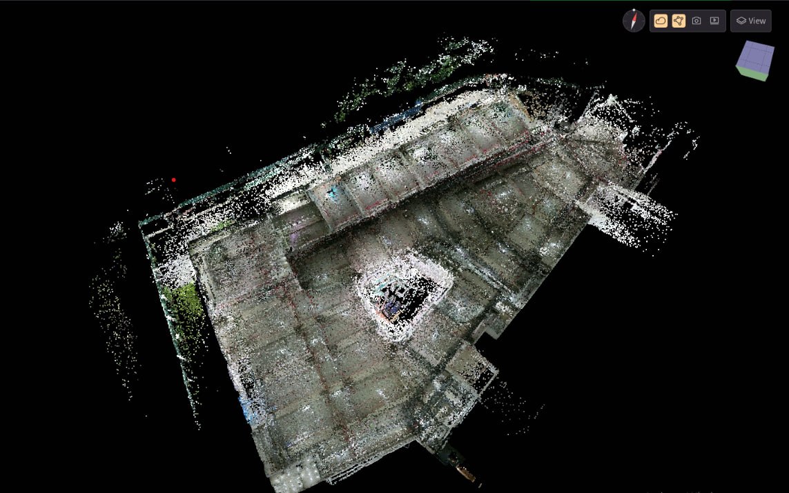
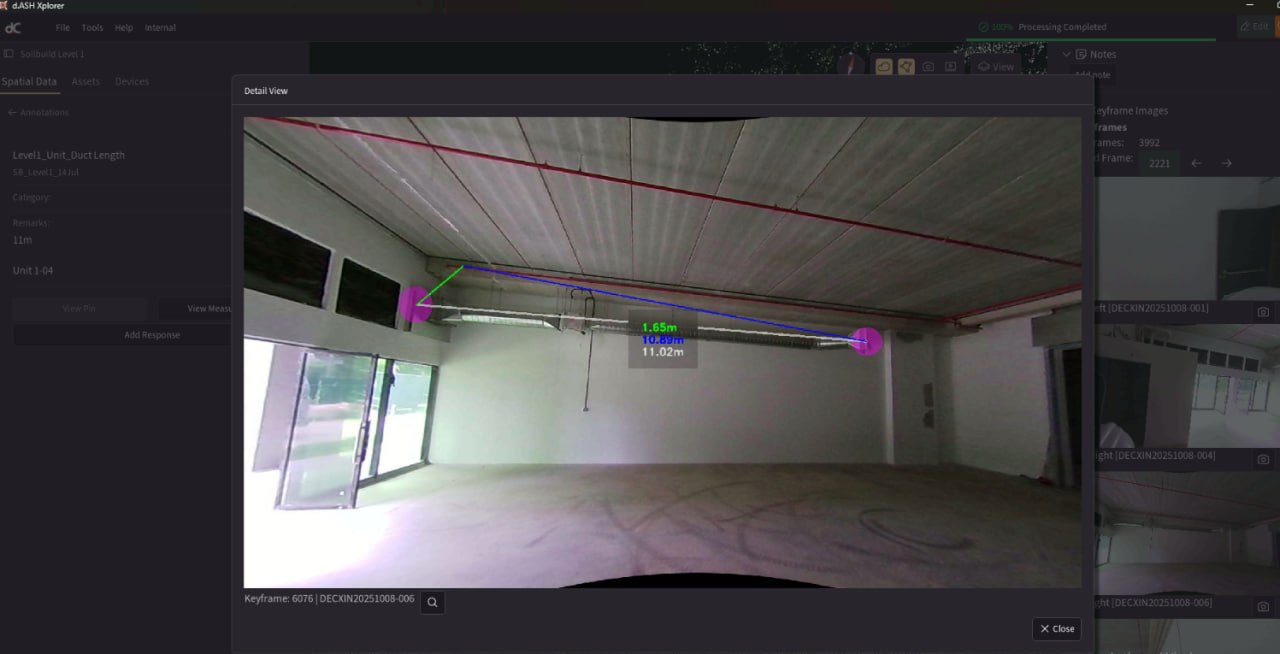
SoilBuild’s Architectural Qualified Person (QP) could then respond directly within the same environment, adding clarifying information, supplementary measurements and other relevant data where required.
This created a more structured feedback loop between the inspector and project team, with both parties working from the same digital representation of the site.
“Working from a common, accurate digital representation gives developers, consultants, contractors, and BCA officers greater confidence in assessing project readiness. With improved transparency and traceability, stakeholders can align more effectively and navigate the TOP approval process with greater clarity and efficiency.”
Gerald Ho, SoilBuild Construction.
Results
The virtual TOP workflow was completed in approximately four weeks, compared with an estimated up to six weeks using the traditional inspection process.
Beyond the reduction in inspection time, the pilot demonstrated several practical benefits:
1. More Precise Feedback
Instead of providing general comments that may require additional discussions to clarify, inspectors could pinpoint the exact location of an issue within the 3D environment.
2. Faster Clarification
Project teams could respond with additional measurements, information and supporting data directly through the same platform, reducing unnecessary back-and-forth.
3. Improved Accessibility
Large sites could be reviewed remotely without requiring all stakeholders to be physically present on site.
4. A Reusable Digital Record
The reality capture provides a digital record of site conditions that can be revisited for subsequent reviews, coordination and verification.
Explore more ways to utilise your reality capture data here.
Key Learnings
The exercise also demonstrated the high level of spatial accuracy achievable with dConstruct’s solution, with measured accuracy of approximately 1-centimetre (subject to site conditions and capture methodology).
While LiDAR is highly effective for large and open areas, smaller or highly confined spaces - such as toilets, narrow corridors and areas less than approximately 1 metre wide - can present scanning challenges. These areas may require supplementary capture methods or additional verification.
For SoilBuild Construction, these technical considerations were outweighed by the overall process improvements and the potential to push the technology further to meet project requirements: “From the onset we were crystal clear on the project outcomes and technology constraints. So, from day one it was always to push the boundaries of the technology to meet all TOP requirements.”
Looking Ahead
Following the successful pilot, SoilBuild Construction will continue to explore the application of dConstruct’s technology across additional projects, including a HDB site and a mega site spanning more than 14 hectares.
These upcoming projects will provide an opportunity to test the workflow across different site types, scales and operating conditions, while identifying further opportunities to improve the virtual inspection process.
“Virtual inspection workflow enhances efficiency and productivity, strengthening the business case for its adoption as a core operational capability.” Gerald Ho, SoilBuild Construction.
dConstruct Robotics extends its appreciation to BCA and SoilBuild Construction for partnering on this flagship full LiDAR based virtual inspection for industrial project TOP. The collaboration demonstrates the potential of digital innovation to streamline inspection and approval processes, while providing a foundation for future digital approval workflows.
Discover how LiDAR virtual inspection can enhance your workflows.
Reach out to us to explore its benefits : hello@dconstruct.ai

Follow us on Linkedin
dConstruct Robotics is a Singapore-based AI and robotics company (founded 2021) building end-to-end reality capture and robot automation tools—like d.ASH Pack and d.ASH Xplorer—for 3D mapping, analytics, and autonomous navigation across construction, facilities, and security.